nostalgeo wins the audience award at Apps For Europe
After winning AppsforGeo and AppsforFlanders, nazka's nostalgeo also won the audience prize at Apps for Europe.
read more

9 september 2026
On September 4, the United Nations General Assembly adopted the resolution “Correct the Map”Good, with 164 votes in favor, one against, and six abstentions. The resolution encourages governments, schools, international organizations, and technology companies to use equal-area projections more frequently, particularly Equal Earth, when the relative size of countries and continents is important. After all, maps help determine how large, close, or important we perceive countries and continents to be. Anyone who frequently looks at a map unknowingly gets a different impression of the world from how it actually looks.
The Mercator projection greatly magnifies areas at high absolute latitudes, both towards the North Pole and towards the South Pole. As a result, Greenland appears larger than Africa, while in reality Greenland is about fourteen times smaller. In the south, Antarctica is extremely magnified. Africa is depicted fairly accurately in terms of surface area. It is primarily in comparison with other countries that things go wrong.
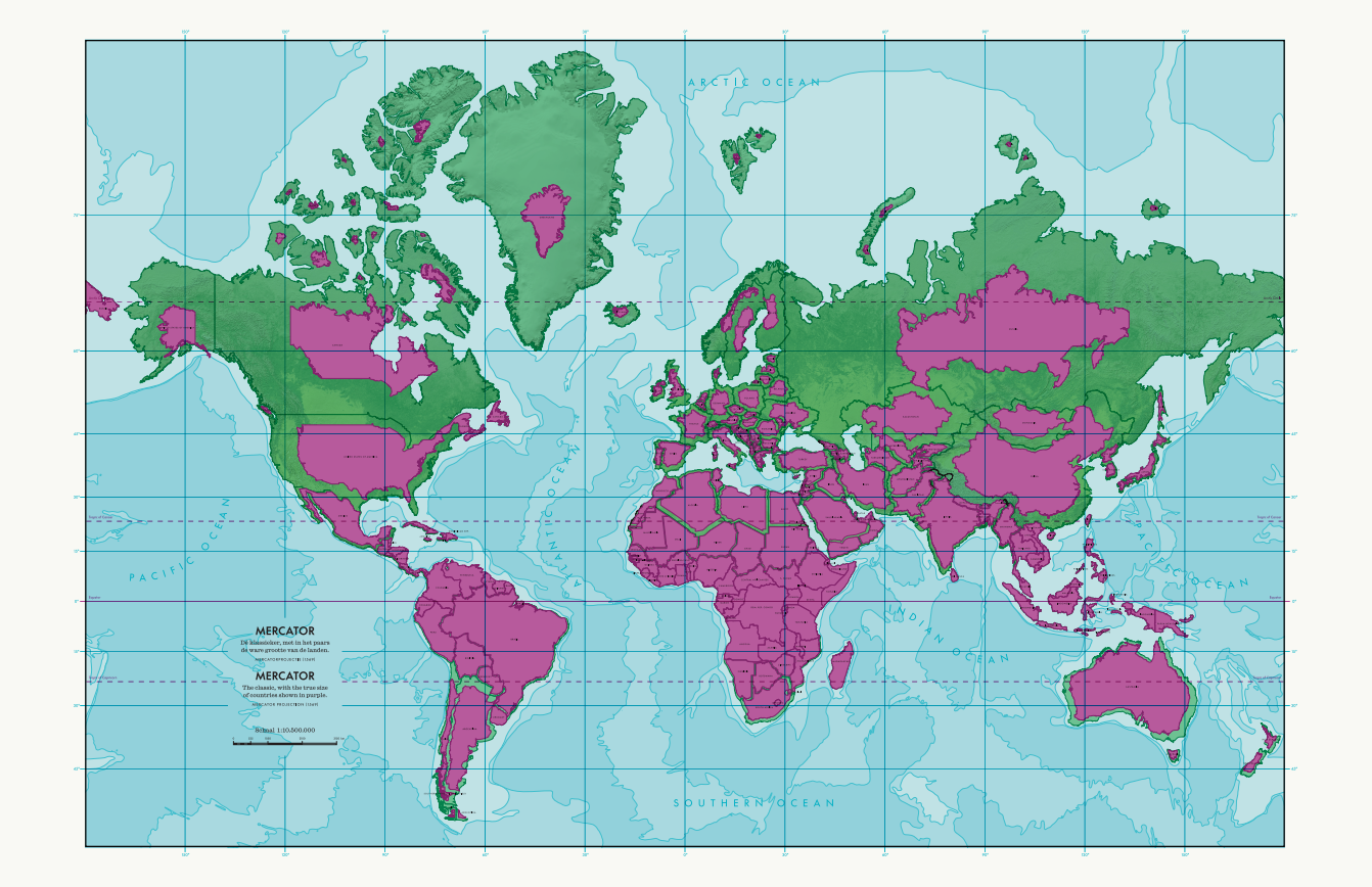
Map sheet from the World’s Largest Atlas, MAP–Mercator, Sint-Niklaas, Belgium
No. When converting a sphere to a flat surface (the map), the following always applies:Choosing is losing. Whoever flattens the sphere must choose which properties are preserved — surface area, shape and angles, distance or direction. Gerardus Mercator developed projection in 1569 for navigation: he chose shape and angles, properties that are particularly useful at sea with a compass. In reality, lines of latitude on our globe become smaller as you move from the equator towards a pole. With navigation as the goal, Mercator made the lines of latitude on the map the same width everywhere as at the equator. As a result, they are stretched horizontally. At 60° north or south latitude, the horizontal size of a line of latitude on Mercator is twice as large as in reality.
This division of the Earth into equal squares also makes the Mercator projection very suitable for digital maps. For instance, almost all digital maps use the web Mercator projection, which serves as the basis for dividing the world into zoom levels and predictable square map tiles, or tiles.
The UN resolution does not ban Mercator and does not prescribe a universal replacement. It calls for a more conscious choice of an equal-area projection — such as Equal Earth — when accurately representing relative surface area matters. In global maps concerning climate, land use, energy, deforestation, biodiversity, population, … surface area is not merely a graphic detail but also part of the substantive message.
Case closed, you might think? Not quite. After all, when we compare a globe to what we see on a map, a conformal projection like Mercator appears more accurate than an equal-area projection due to shape distortion. This is not unimportant for our perception of what appears correct and what does not.
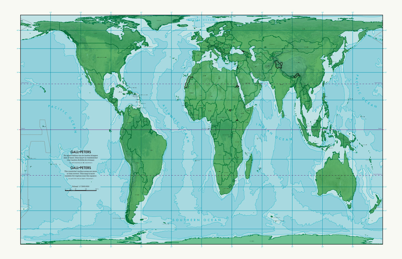
There are many equal-area projections. In the MAP-Mercator museum in Sint-Niklaas, Belgium, you can admire a world map in the Gall-Peters projection.
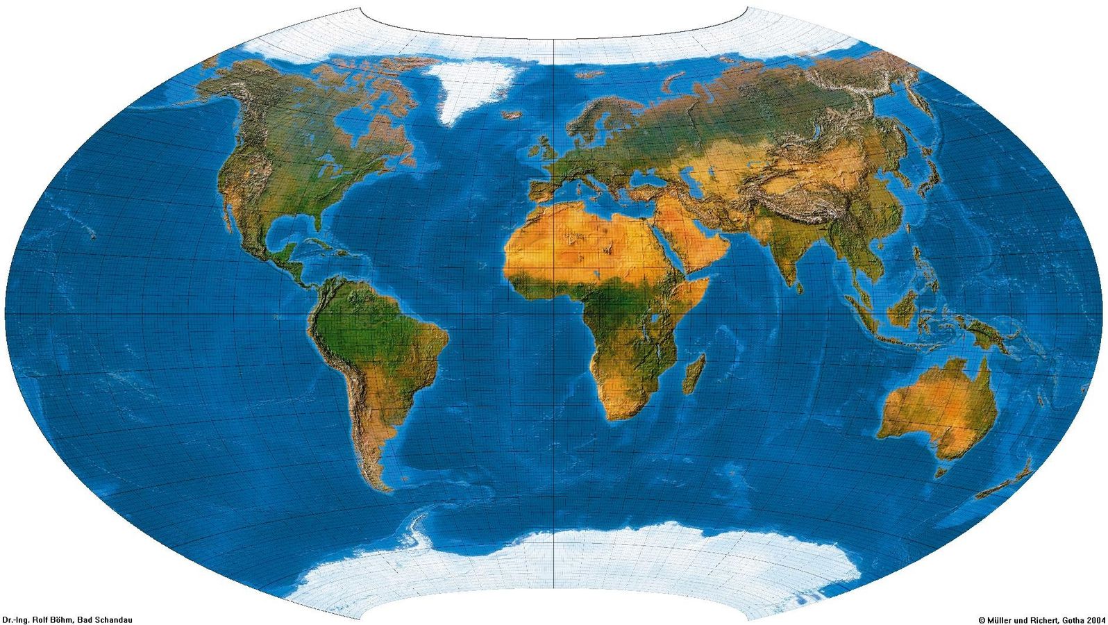
The Belgian cartographer Frank Canters developed a series of projections that do not aim to perfectly preserve a single property, but seek a balance between area, shape, and distance. The Canters W14 projection for example, is designed as a general world map with as little average distortion as possible.
For a general world map, this offers a well-thought-out compromise: no extreme magnification like with Mercator and no pronounced shape distortion like with some area-preserving projections. Belgium missed the opportunity to put forward another world projection after Mercator. After Gerardus Mercator, Belgium could have projected a new, balanced vision of the world map with Frank Canters. With a genuine Belgian compromise—complicated, but every party feels they have won.
Anyone wishing to discover for themselves how maps shape our view of the world can visit MAP – Mercator in Sint-Niklaas (in Belgium of course). It is the only Belgian museum entirely dedicated to cartography. There you will find the original globes of Gerardus Mercator, interactive installations, contemporary stories about maps, and the largest atlas in the world.
More info about MAP-Mercator: https://mapsint-niklaas.be/
For the map projection nerds among us: https://map-projections.net/
NOTE: When writing this blog, the writer used AI as an editorial assistant: to test ideas, refine phrasing, and clarify technical explanations. The content choices, source checking, and final editing are human.