Looking for tracks "under the radar"
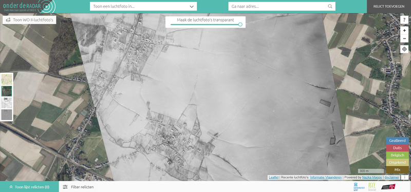
The interactive map "Onder de Radar" invites you to use a unique collection of WWII aerial photos to search for remnants of WWII such as camps, execution sites, bombings, cemeteries, ... Nazka developed this map on behalf of the province of Limburg.
The old aerial photos give a unique picture of Limburg at the time, during and just after WWII. Apart from exploring, visitors are invited to track down relics themselves and make them visible again to all Limburgers.
An inventive and user-friendly search filter allows you to quickly and efficiently search through the large collection of old aerial photos, or show a random photo in a Limburg village. The simple upload tool makes it easy to upload your own stories. Your contribution is first reviewed in the "back-end" by a curator from the province before being published.
The "Under the Radar" map was custom developed, it is an innovative and user-friendly tool that makes the valuable history of the province of Limburg visible again and invites further exploration and discovery.